

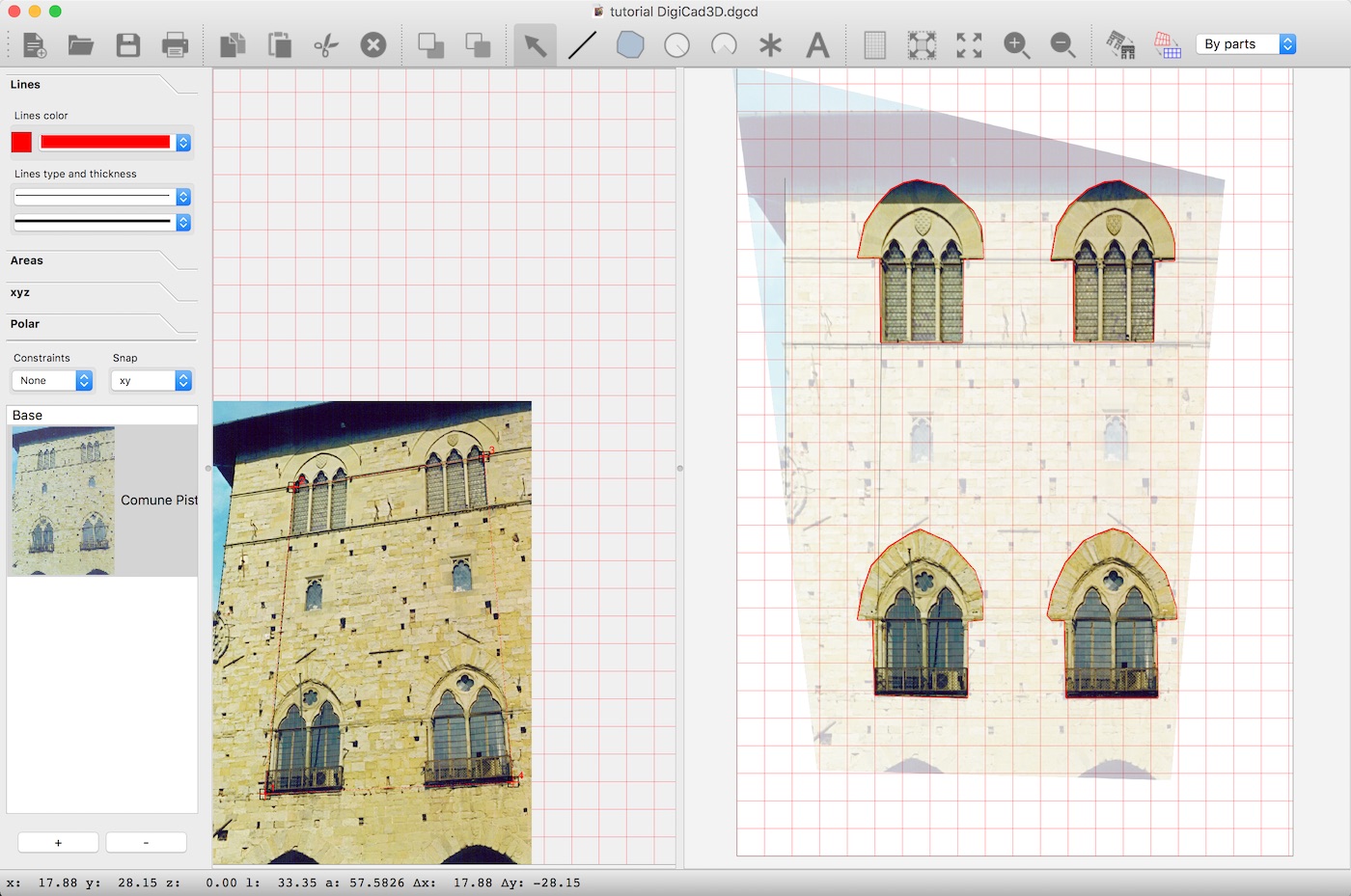
DigiCad 3D is an excellent tool for dealing with images, drawings, photographs of building, regular or irregular surfaces and maps. It operates either directly on raster images or by digitization. It is used in aerial and architectural photogrammetry, cartography, and mapping, for which it offers powerful, easy-to-use and exclusive instruments.
Based on four or five fixed points of reference, you can operate directly on the image or on elements drawn on the image.
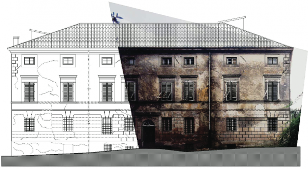
In the first instance, you obtain a new image without perspective distortion and to scale. In the second case, if the original image is digitized, the Dynamic Attach feature allows you to view both the digitized drawing and the straightened drawing on screen at the same time. So you have total control and increased flexibility – you can check the accuracy of your data as you work.
Invalid Displayed Gallery
Elimination of perspective distortion
Based on four or five fixed points of reference, you can operate directly on the image or on elements drawn on the image.
In the first instance, you obtain a new image without perspective distortion and to scale. In the second case, if the original image is digitized, the Dynamic Attach feature allows you to view both the digitized drawing and the straightened drawing on screen at the same time. So you have total control and increased flexibility – you can check the accuracy of your data as you work.
Partial transformation
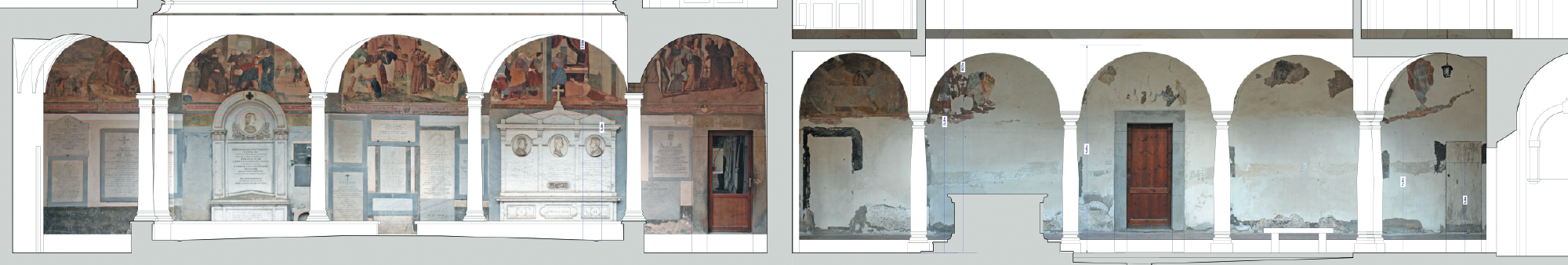
It is possible to transform just a part of an image, delimited by a polygon, drawn either on the original image or where it is to be transformed. This function, along with the new possibilities for transparency described below, enables you to select relevant details from the original images or photos – construction details, decoration, frescoes, special materials, damaged elements, etc.
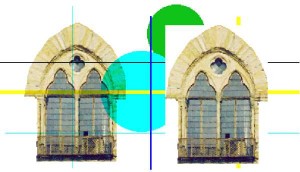
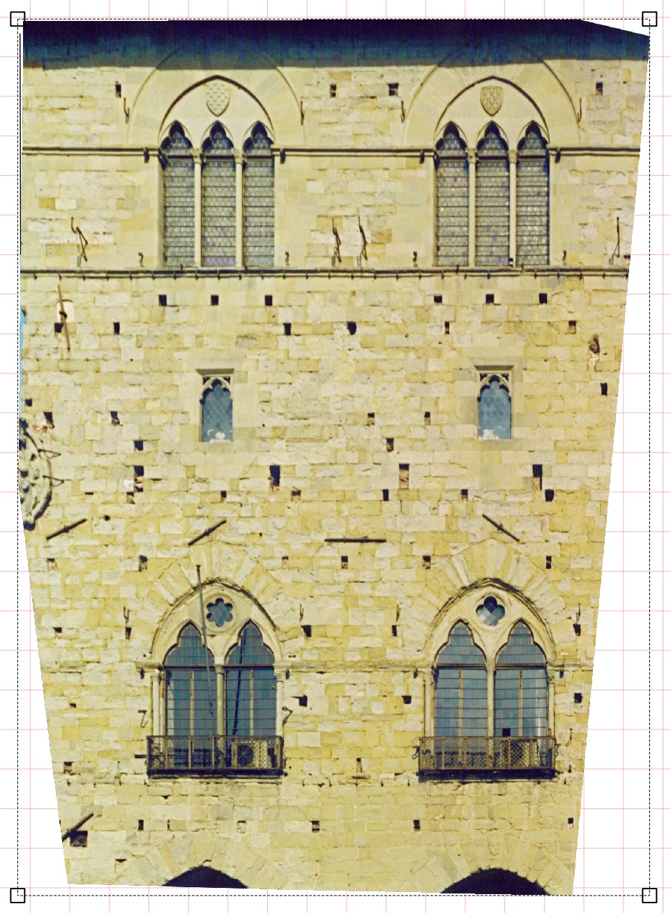
Extraction of architectural details with real measurements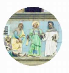
Transformed image delimited by any shape
Transparent images
Resulting images can be transparent or opaque. A transparent image can be superimposed on drawings or other images and is totally see-through. For example, you could superimpose a particular construction detail over a technical drawing or one map over another. An opaque image obviously covers whatever is beneath it.
Immagini trasparenti e opache
Mosaics
Mosaic work is easy with DigiCad 3D. You can join confining or superimposed images such as construction details within a building facade, or two maps scanned to different scales. The accuracy of the mosaic is guaranteed by the common origin of the fixed measurements, by the transparency of the images and by their delimitation.
DigiCad 3D can also join a number of images with missing parts.
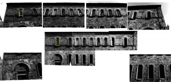
Composizione di più foto in un mosaico
Approximated transformation without measurements
Even without precise or detailed measurements, it is possible to make an attempt at transformation, using those elements held to be vertical or horizontal.
Straightening up curved surfaces
Until now, photogrammetry programs using just one photo have been limited to straightening up flat surfaces only.
DigiCad 3D has broken that barrier! It allows you to straighten up curved or irregular images.
Buildings like the Coliseum in Rome, or the Leaning Tower of Pisa, the Capitol Hill in Washington or the Casa Mila of Gaudì in Barcelona? No problem for DigiCad 3D!
Straightening up is achieved using a mesh or grid, regular or irregular, which is then superimposed on the irregular image, with fixed reference lines or points.
With the same method an aerial photo can be exactly superimposed to a map.
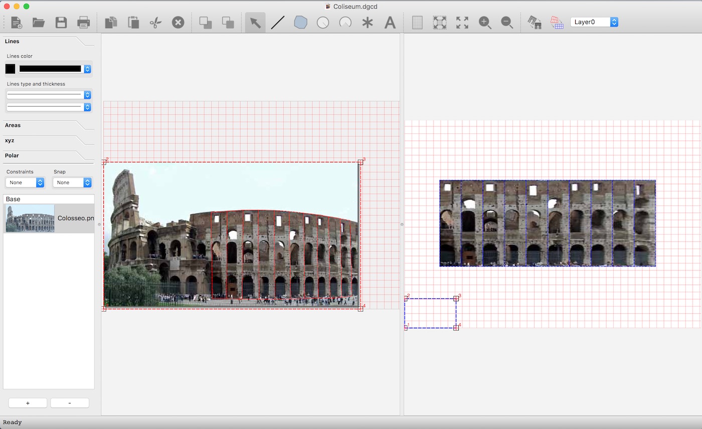
Rome – Colosseum (Perspective and transformed)
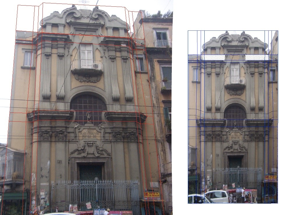
Straightening of a complex facade
Elimination of optical deformation
Wide-angle, or other special lenses can cause serious optical deformation to images; straight lines can become curves and a flat surface can take on the familiar ‘barrel’ or ‘cushion’ appearance.
DigiCad 3D offers a much faster method, based on an algorithm which deals quickly with the common types of optical deformation in wide-angle and zoom images.
It allows you – for several different lenses – to manage correction data, file it and retrieve it from by a menu.
Mesh system is still available in the new version. Indeed it is the best way of correcting irregular optical deformation.
 Elimination of optical deformation
Correction and georeferencing of maps
As with images, so maps can have perspective distortion eliminated , removing distortions on the support material or errors in copying, scanning and printing. DigiCad 3D allows one to work on maps joining and superimposing raster and vectorial maps and to define any kind of mapping coordinate references.
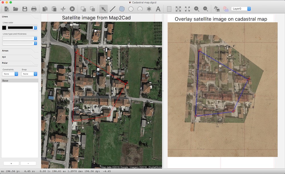
Use of satellite images
The Map2Cad function allows you to import perfectly scaled portions of Google Maps images into DigiCad 3D.
Google Maps are composed of series of blocks at various scales of representation of known dimensions.
Map2Cad queries the Google Maps database directly and extracts the original piece in order to correctly import it into DigiCad 3D.
Here is an example of the use of a satellite map superimposed on a cadastral map to identify the position of new buildings.
Textures
DIGICAD 3D is the ideal tool for creating textures from photos of facades or construction details, decorations, paintings and even whole facades for use on simplified 3D models. Textures selected for use on 3D elements with a rendering program must be completely flat.
Importing – Exporting
DIGICAD 3D has extremely flexible procedures for importing and exporting, which make it compatible with all other programs.
The digitized drawing or transformed image can be transferred to other applications using cut-and-paste, filed in GIF, JPEG, TIF, PICT, BTM, 3D DXF or DWG, ASCII XYZ, PDF and others graphic formats.
You can import documents in XYZ-ASCII format and drawings in DWG, DXF, CXF, BTM, JPG, PNG and many others.
Conversion of PDF
PDF files created by vector programs are converted into editable elements such as lines, polygons, texts, images, with original Layesr retention.
DigiCad 3D can convert vectorial PDF to DigiCad 3D elements as lines, polygons, text, images, circles etc.
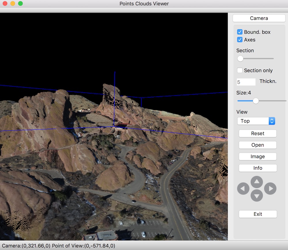
Point clouds
DigiCad 3D allows you to import and manage point clouds through the Clouds2Cad function.
Usage is similar to Map2Cad, with a catalog of images previously created with Clouds2Cad.
Clouds2Cad allows you to access the point cloud management panel, which allows the following operations:
- Importing a point cloud
- Three-dimensional visualization of the point cloud in axonometry and perspective
- Interactive navigation and predefined views
- Creating sections
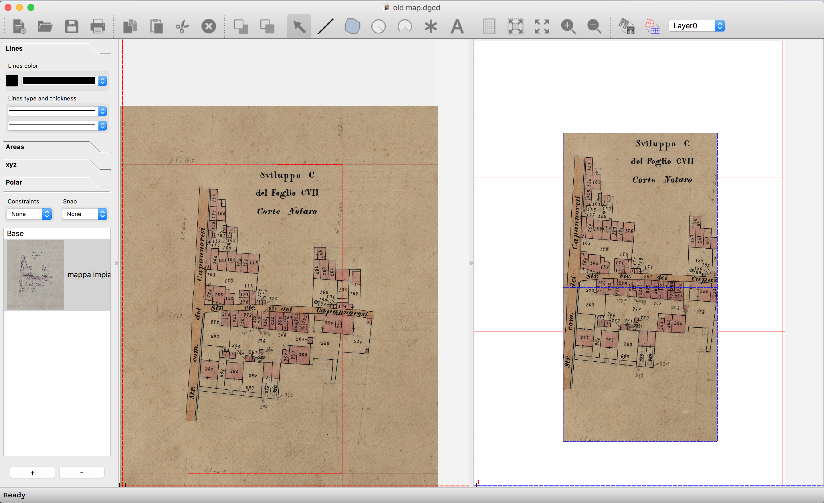
Calibration of old maps
The old maps are available from scans of the original maps, which contain a series of errors due to the deformation of the maps over time.Using the mesh allows you to recalibrate the map exactly with the following steps:
Setting the correct scales in Graphic parameters, corresponding to the imported map
Adding the map in the Origin view
Creating a mesh with the number of rows and columns based on the part of the map to be corrected and dimensions equal to the distance of the parametrization of the paper.
Move the vertices of the origin mesh with the mouse, making them exactly correspond to the intersections of the grid of the paper parametrization
The target mesh already has the correct dimensions. Eventually it can be moved to the position of the sheet where to obtain the result
Execute the Transform with mesh command, with the choice of the linear deformation
Here is an example of calibrating a part of the map.
Automatic vectorization
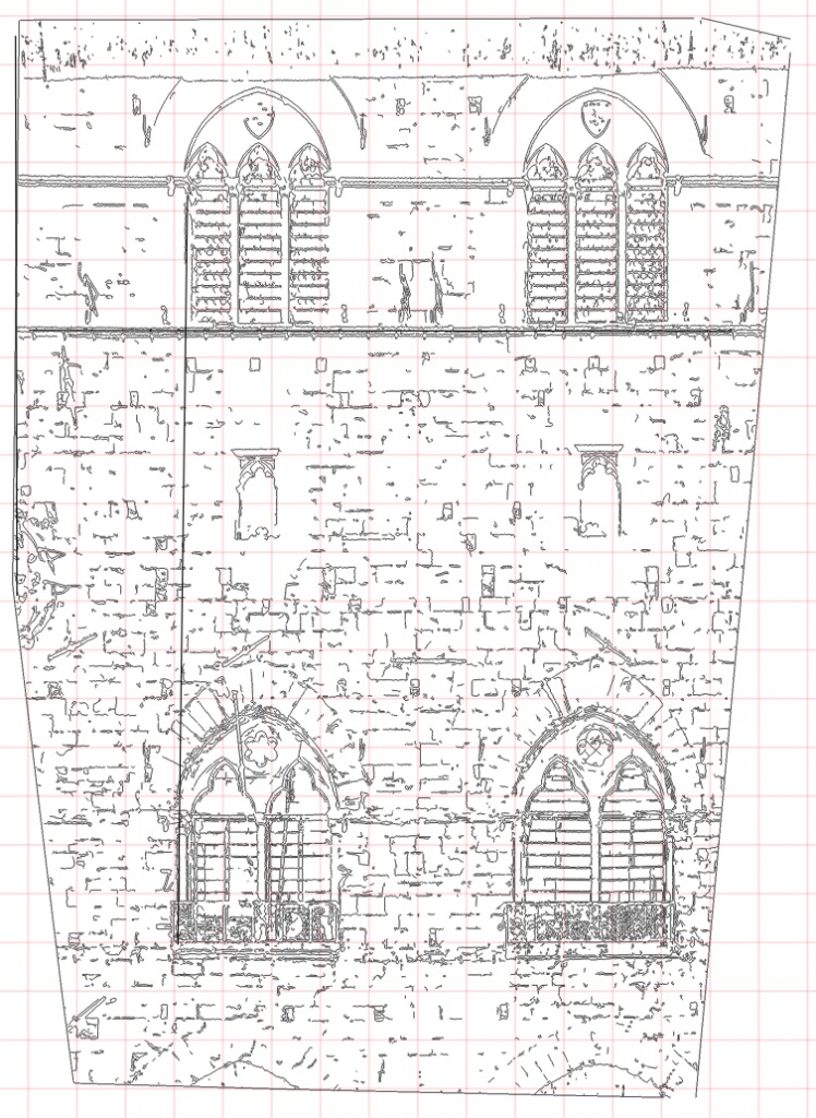
Automatic extraction of the contours of the images with control of the threshold value.
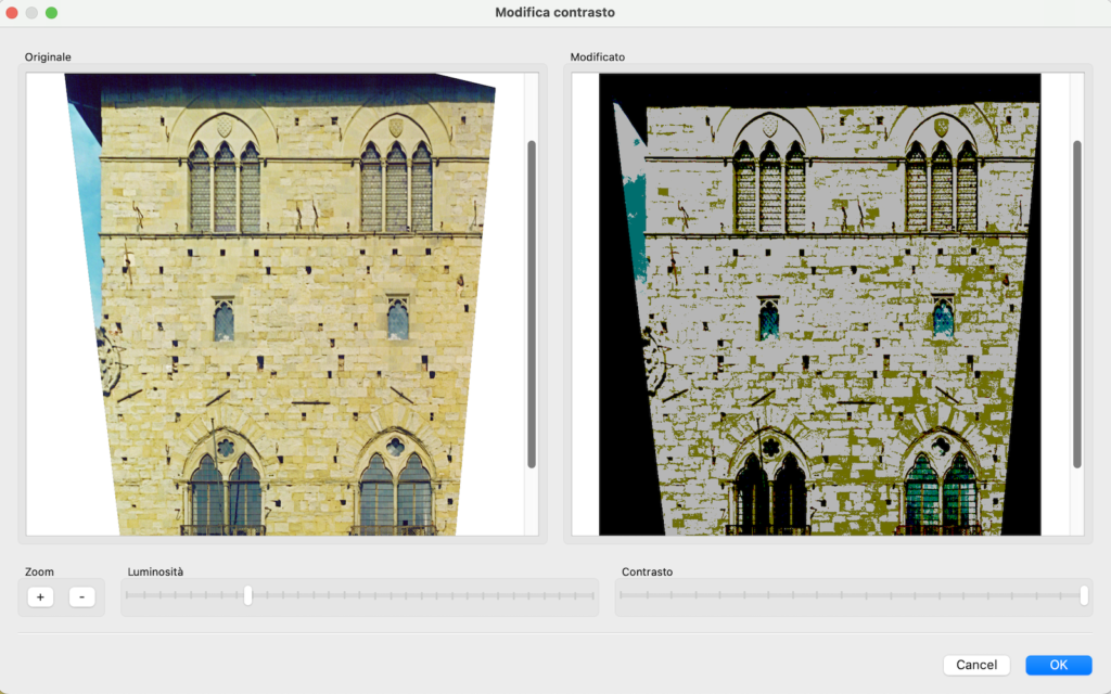
Brightness-Contrast
The procedure for changing the brightness and contrast of images allows both to improve photos, and to highlight the most important information. It also improves the final result. I can highlight, for example, the weaving of stones in a historic building.
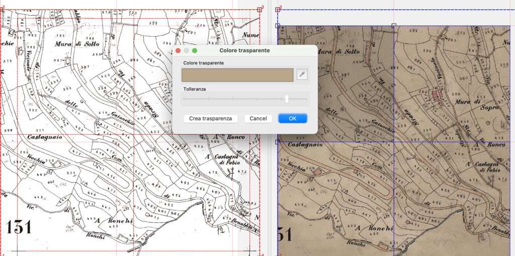
Transparent color
This command makes a color range transparent. The color can also be indicated by clicking with the Dropper tool anywhere on the screen. Depending on the perfume chosen, colors within a certain range of variation are made transparent.
In the example below we see a plan whose lower part is made transparent, thus allowing to superimpose the map on other maps or drawings.
Resample images
Images can be resampled, changing the resolution, color depth and memory usage, optimizing them according to the type of use and the final quality required.
And more …
Automatic snap function at points inserted with/ or without zeta; perpendicular, parallel, horizontal and vertical blocks; delete, undo/redo; modification of color, thickness and fill; definition of unity of measurement, graphic parameters; fast scroll; zoom-box; keyboard shortcuts; background function during digitizing and plotting.
DigiCad 3D can be used with Nonio A and Nonio C to superimpose topographical field surveys and cartographic charts.
Drawing deformations can be corrected using separate coefficients for the x and y axes.
DigiCad 3D also includes various enlargement/reduction levels, patterns, hatchings, markers, lines of different colors and thickness, texts, fills, circles, arches, and keyboard options.
- Architectural elevations from photographs
- Elimination of perspective distortion
- Partial transformation
- Mosaic work
- Transparent images can be superimposed on technical drawings and bitmaps
- Regular- or irregularly curved surfaces can be straightened out
- Optical deformation caused by photo lenses can be eliminated
- Approximate and precise transformation
- Perspective and Linear Transformation
- Ability to work with large format drawings
- Automatic union of parts of drawings
- Direct transformation of photos or scanned images
- Geo-reference
- Elimination of map distortions
- Creation of texture from photos
- Adjustment of brightness and contrast of images
- Resampling images based on resolution and color depth
- Management of transparent parts of images according to the indicated color
- Snap and Block functions
- Ability to move elements or groups of elements
- Direct integration with Nonio C, and Domus. Cad
- Import DWG, DXF, XYZ, JPG, BTM, GIF, JPEG, PNG formats and others format
- Export i DWG, DXF, XYZ, PDF, JPG, BTM, GIF, JPEG, PNG, PDF and many others
- Rotation, modification of the transparency, of the resolution and of the number of colors of the raster images
- Conversion from vector PDF to vector drawing elements
- Exact images re-scale and real measurements.


